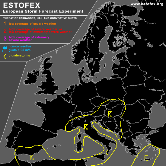
STORM FORECAST
VALID Fri 28 Apr 06:00 - Sat 29 Apr 06:00 2006 (UTC)
ISSUED: 27 Apr 19:07 (UTC)
FORECASTER: TUSCHY
SYNOPSIS
Main change will be infiltration of a dry and stable airmass over parts of CNTRL Europe, finally shutting down orographically driven TSTM development....Otherwise, still broad area left, where daytime driven convection can be expected with a threat of marginal hail and sub-severe wind gusts.
Pool of pretty cold mid-level air will reach NW Germany, Belgium and the Netherlands during the early noon hours and an isolated electrified shower can't be ruled out, but current thinking is that airmass will be not conducive for scattered TSTMs and will therefore not highlight an area.
DISCUSSION
...SE Spain...
Weakly developed depression over extreme S-Spain ( if it will finally be a closed depression at all ) and a flat upper-level trough, crossing the area during the afternoon hours, create an environment with moderate instability release, DLS up to 20m/s and enhanced LL shear ( mainly offshore east of the Strait of Gibraltar )... Main limiting factor for significant development will be missing forcing, but each emerging TSTM should pose a risk for an isolated severe wind gust/ large hail threat... Expected coverage will be too low for warranting higher probabilities ATM.
#