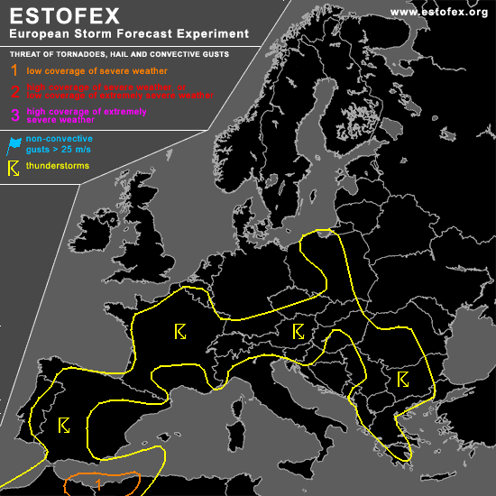

STORM FORECAST
VALID Mon 24 Apr 06:00 - Tue 25 Apr 06:00 2006 (UTC)
ISSUED: 23 Apr 22:25 (UTC)
FORECASTER: GROENEMEIJER
A threat level 1 is forecast across northeastern Morocco and northwestern Algeria
SYNOPSIS
Monday at 0600 UTC... at 500 hPa a large low pressure centre is located over eastern Morocco. A vorticity maximum over the English Channel is expected to move eastward during the forecast period.
DISCUSSION
...northwestern Algeria and northeastern Morocco...
Rather strong deep-layer shear and MLCAPE values of 500-1000 J/kg are expected to develop over northwestern Algeria and northeastern Morocco as moist air from the Mediterranean flows under a deep mixed layer that is advected northward from the Sahara desert. A couple of strong storms, including supercells, are to be expected. These will be capable of producing local damaging winds and may produce large hail in places.
...France...
Scattered to widespread convective storms are expected to form over much of France. Moderate 15 m/s 0-6 km bulk shear is forecast over western and central France, which suggests that well-organized multicells are possible. These may produce some marginally large hail and strong winds. The overall threat, however, appears too low to warrant a threat level 1.
#