
STORM FORECAST
VALID Sun 23 Apr 06:00 - Mon 24 Apr 06:00 2006 (UTC)
ISSUED: 22 Apr 16:52 (UTC)
FORECASTER: DAHL
SYNOPSIS
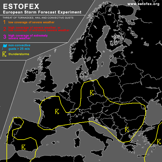
SW European upper low will continue tracking into the NW Maghreb States as it phases with NRN stream vort max ... which will move across W France late in the period. Downstream small upper low over N Germany will slowly be re-integrated into the upper frontal zone ... thereby accelerating slowly northeastwards late on Sunday. Weak vort maxima should continue to affect the central and E Mediterranian regions.
DISCUSSION
...SE Spain...
Focus for potentially severe convective development seems to exist over SE Spain in weakly unstable air mass near the NE periphery of the upper cut-off low. Deep shear should exceed 20 m/s ... with 10 + m/s 0-1 km shear ... and 0-3 km SRH on the order of 300 J/kg. However ... strong WAA suggests that storms may tend to be elevated ... though BL air mass should possess some CAPE as well ... and may thus be tapped by any strong convective cell. Those storms that become SFC-based will have the potential to become supercellular ... with an attendant hail/wind threat ... though especially close to the coast where LCL heights should be rather low ... a tornado or two could occur. Confidence in widespread SFC-based evolution is limited ATTM ... and a level one threat does not seem to be warranted.
...Germany...
Mesoscale band of rather intense mid/upper winds is surrounding the small upper low over Germany ... but indications are that shear in the inflow layer will remain negligible. Instability should be rather meager with nearly neutral thermodynamic profiles and rather low EL heights. Chance of a few multicellular storms persists ... posing a threat for strong wind gusts and some hail ... which may briefly attain severe levels ... but allover severe threat appears to be too limited for a categorical risk.
#