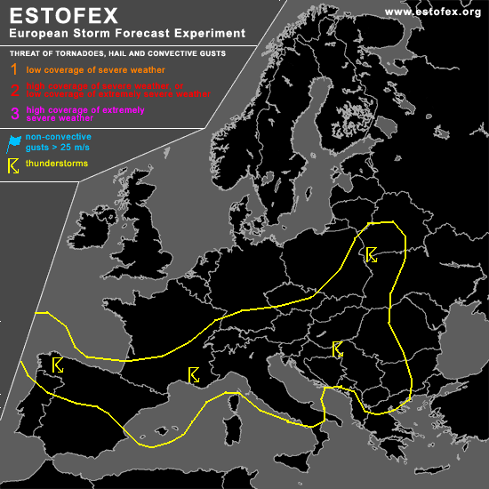
STORM FORECAST
VALID Thu 20 Apr 06:00 - Fri 21 Apr 06:00 2006 (UTC)
ISSUED: 19 Apr 22:20 (UTC)
FORECASTER: TUSCHY
SYNOPSIS
Most parts of central Europe will see diffuse pressure spreading combined with weak to isolated moderately instability release... Therefore, a pretty widespread area of TSTM development can be expected with an attendant risk of mostly sub-severe wind gusts and marginal hail.
Main concern for isolated severe TSTM development will evolve with developing depression over the Bay of Biscay during the latter part of the forecast period.
DISCUSSION
...NW and N Spain and parts of N Portugal...
As a result of an intensifying trough west of Ireland, strenghtening depression is forecast to slowly shift towards the SE, although degree of intensification is not that impressive and system should also be vertically stacked pretty fast....Cold front will move onshore along the coastal areas of NW-Spain during the night hours, but bad thermodynamic conditions will preclude any significant TSTM development... Main concern for isolated TSTM development will develop during the morning hours, when postfrontal airmass will start to affect the area of interest... Enhanced LL shear will be present with an isolated severe wind gust report, but expect TSTM coverage will be too marginal for issuing higher probabilities ATM.
#