STORM FORECAST
VALID Sun 16 Apr 06:00 - Mon 17 Apr 06:00 2006 (UTC)
ISSUED: 16 Apr 02:21 (UTC)
FORECASTER: VAN DER VELDE
SYNOPSIS
A low pressure area moves from northern France towards northern Poland. Marginal instability is present at the cold front and in the postfrontal airmass over central Europe. An upper trough causing an unstable airmass approaches Spain. A stronger depression affects the west coast of SW Norway.
DISCUSSION
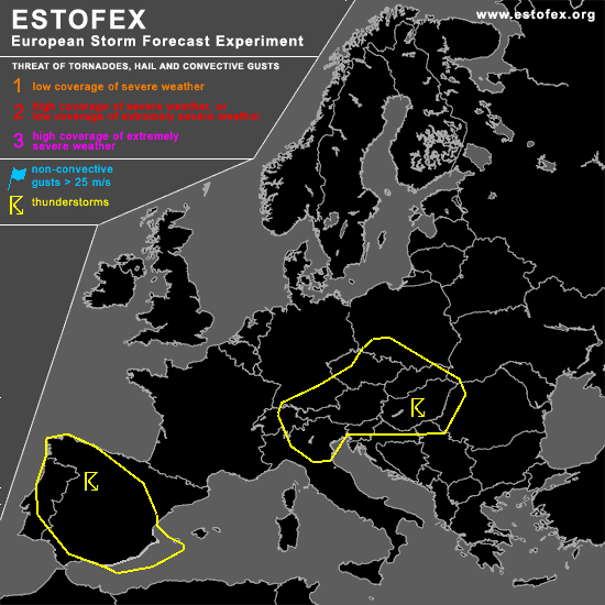
...Central Europe...
GFS shows only very patchy CAPE fields, though the lifted index area is consistent but slightly positive. Relatively shallow convection may develop. Strongest CAPE signals come from NMM model, featuring an area over Hungary. PVA of the small upper shortwave trough remains in the northern parts of the area, providing a focus for convection, whereas the stronger deep layer shear zone covers the south part of the Alps and former Yugoslavia, with even more marginal conditions for convection. NMM does show patch of enhanced 0-1 km shear near the Czech Republic, and GFS consistently gives a large patch of strong 0-1 km shear over southern Germany, Czech Republic and northern Austria. Enhanced SR helicity is present over this area as well, but less so in NMM than GFS. Because uncertainty exists that organised convection will develop, will go without level 1, but an isolated storm may produce a severe gust or a brief tornado in such an environment. If organised convection develops, or 12Z soundings show significant low-level CAPE in combination with adequate shear conditions, may consider level 1.
#