
STORM FORECAST
VALID Thu 13 Apr 06:00 - Fri 14 Apr 06:00 2006 (UTC)
ISSUED: 12 Apr 19:03 (UTC)
FORECASTER: GATZEN
SYNOPSIS
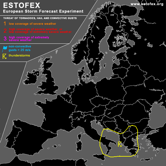
To the south of intense polar trough over North Sea and western Scandinavia ... upper subtropical ridge builds over southwestern Europe. To the southeast ... upper trough over Alpine region/northern Mediterranean moves eastward und shows a tendency to cut off over eastern Mediterranean later on. This large-scale situation should be associated with rather calm convective day over Europe. Best chances for thunderstorms will be in the center of the Mediterranean short-wave trough filled with cold airmass ... characterized by neutral to steep lapse rates. Weak vertical wind shear is forecast in the range of the trough center ... and severe convection should be not likely. East of this propagating trough ... relatively cool and dry airmass has entered southern Adriatic, Greece, and Aegean Sea behind a cold front. Although some cyclogenesis is expected as the upper vort-max/trough approaches ... we do not think that boundary layer moisture will recover within a few hours ... and amount of instability should be weak ... limiting the chance for initiation. Developing convection may be influenced by strong DLS ... so that likelyhood of severe convection will be enhanced ... and later observations will be awaited for a possible update.
DISCUSSION
#