STORM FORECAST
VALID Tue 11 Apr 22:00 - Wed 12 Apr 06:00 2006 (UTC)
ISSUED: 11 Apr 22:19 (UTC)
FORECASTER: TUSCHY / GROENEMEIJER
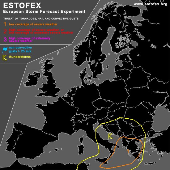
A threat level 1 is forecast across extreme southern Italy, parts of Albania and Greece, the Ionean Sea and northwester Aegean Sea
SYNOPSIS
refer to storm forecast and below...
DISCUSSION
...southern Balkans, Greece, Ionean Sea and northwestern Aegean Sea...
A westerly jet streak south of a closed low at mid-level was analyzed over the southern Thyrrhenean Sea at 21:00 UTC. Strong destablisation is forecast as strong upward motion affects dry air flowing into the jet streak's left exit-region. Scattered storms forming over over S-Italy are probably evidence of this. An eastward shift of the system and a further intensifying jet should yield a favorable environment for convective storms to develop over the Ionean Sea, western Greece and the F.Y.R. of Macedonia.
0-6 km bulk shear in the order of 30-40 m/s should promote storm organization into bowing segments with an attendant severe/damaging wind gust risk. Additionally, rotating storms are possible given the very strong shear. It is not ruled out that some storms remain surface-based, given the strong lift that will likely affect the lower troposphere as well. Strong low-level shear could allow for a tornado or two as well especially in western Greece and Albania and across the coastal regions of the northwestern Aegean Sea.
#