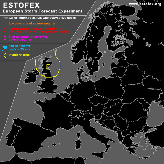
STORM FORECAST
VALID Sat 08 Apr 06:00 - Sun 09 Apr 06:00 2006 (UTC)
ISSUED: 07 Apr 22:33 (UTC)
FORECASTER: TUSCHY
SYNOPSIS
Broad upper-level trough, placed over the North Sea, will continue to slowly shift towards the east... Most parts of Europe will be piled with a cool and stable airmass....Again there is a chance for isolated and weakly electrified TSTMs to develop over parts of the United Kingdom and the North Sea... mainly, when cold core of upper level low will cross the highlighted area during the morning/noon hours...Thermodynamic and kinematic parameters too low/weak for an organized TSTM threat.
Cold front, moving southward over Germany, could produce isolated TSTMs but instability too low for warranting an highlighted area ATM.
Same for SE France, where weak signals of convective precipitation are shown, but only traces of instability will preclude scattered TSTMs to develop.
DISCUSSION
#