STORM FORECAST
VALID Fri 07 Apr 06:00 - Sat 08 Apr 06:00 2006 (UTC)
ISSUED: 06 Apr 19:26 (UTC)
FORECASTER: TUSCHY
SYNOPSIS
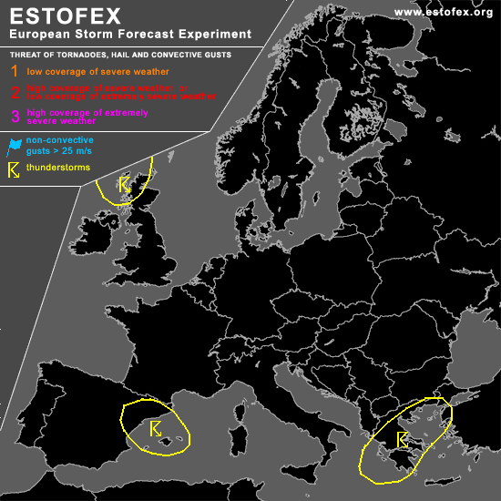
No significant change occurred during the past 24 hours... Strong upper-level trough is still situated over parts of northern Europe... As a result of the approach of a well developed upper-level jet streak entering the trough from the NW, positive tilted axis is expected to slowly shift towards the ESE and taking up a more neutral position... Although models indicate only weak instability signals ( mainly offshore ), expect a few short lived and weakly electrified storms to develop over Scotland, when cold airmass advection in the mid levels will help to further steepen lapse rates.
The rest of Europe will see pretty stable conditions in an environment with weak pressure differences... I highlighted a few regions, where environment for isolated to scattered TSTM development will become more favorable, but very low instability values and separation of best shear should preclude any organized convection mode.
DISCUSSION
#