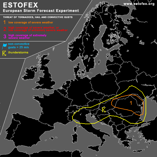

STORM FORECAST
VALID Wed 29 Mar 07:00 - Thu 30 Mar 06:00 2006 (UTC)
ISSUED: 29 Mar 07:32 (UTC)
FORECASTER: GROENEMEIJER / TUSCHY
A threat level 1 is forecast across Hungary, Romania, Moldova, Bulgaria, extreme southwestern Ukraine
SYNOPSIS
Wednesday at 06 UTC... a rather intense shorwave trough that was analysed over Slovenia is expected to track eastward during the day, crossing the northern Balkans.
DISCUSSION
...Hungary, Romania, Moldova, Bulgaria, southwestern Ukraine...
Despite the lack of solar heating, some electrified storms appear to by ongoing over parts of Hungary and the western Ukraine, indicating that GFS may be somewhat conservative with its instability. It is expected that ascent ahead of the approaching shortwave and insolation will further destabilize the air-mass across the northern Balkans and that rather widespread thunderstorms will form.
Wind speeds of near 25 m/s are forecast at 700 hPa per GFS, implying that strong shear will be present in the lowest three kilometres of the troposphere. Given that this is the case, and that strong forcing for upward motion is expected, one or more squall-lines will likely form. These will pose a threat mainly of severe wind gusts and isolated large hail. A tornado or two may be possible as well.
#