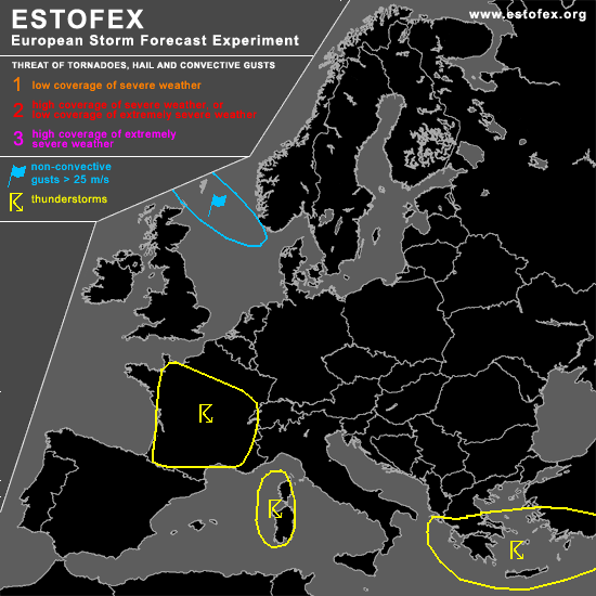

STORM FORECAST
VALID Fri 24 Mar 06:00 - Sat 25 Mar 06:00 2006 (UTC)
ISSUED: 23 Mar 23:38 (UTC)
FORECASTER: GROENEMEIJER
SYNOPSIS
Friday at 06 UTC... a broad westerly mid-level flow is present over southwestern and west-central Europe. A trough extending from Ireland to southwestern France moves slowly eastward. Rising motions will result in a broad area of precipitation and is forecast to be followed by a couple of convective storms, of which some will likely be thundery. Further east... a shortwave trough extends from mainland Greece southward and moves quite rapidly eastward.
DISCUSSION
...western and central France...
Convection is expected to develop in an environment of rather strong shear with typical values of 0-1 bulk shear in the 10-15 m/s range and around 20 m/s in the 0-6 km layer. A very small amount of instability is forecast, so that the threat of severe storms should be rather low despite the strong shear. Still, if stronger instability manages to develop, for example in longer sunny spells, more intense updrafts may develop and a marginal severe threat may develop as a result.
...Crete, southern Turkey...
As the intense shortwave moves across the area, significant destabilisation is expected to occur, which should fuel a couple of well organized storms, probably organized in a linear convective system. Rather strong wind gusts and small hail may occur, but most events should remain subsevere.
#