
STORM FORECAST
VALID Tue 21 Mar 06:00 - Wed 22 Mar 06:00 2006 (UTC)
ISSUED: 21 Mar 02:14 (UTC)
FORECASTER: VAN DER VELDE
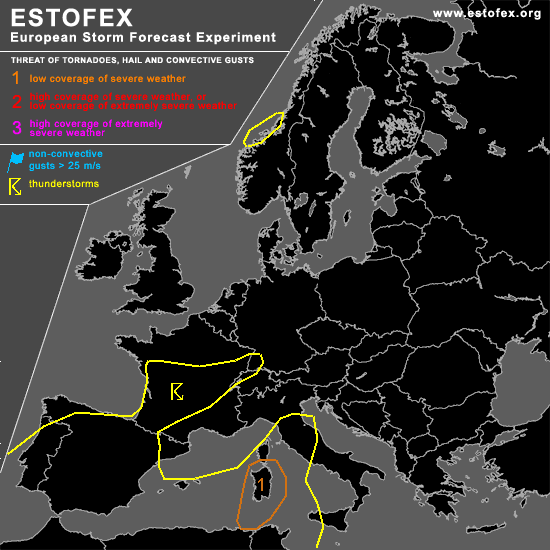
A threat level 1 is forecast across Sardinia
SYNOPSIS
Main feature of interest is the upper/surface low pressure system in the Gulf of Biscay, which is associated with marginally unstable profiles, leading to convective development over mainly the elevated grounds of France and Spain. Kinematical conditions are benign, as will be the storm motions, so that localized moderate precipitation amounts (>10 mm) will be possible from some storms.
DISCUSSION
...Sardinia...
Under the plume of dry midlevel air advected from northern Africa, some CAPE could be built up. Most likely this will be elevated over sea, but over northern Africa and Sardinia the boundary layer may grow deeply enough and allow surface-based convection. This is particularly a concern due to synoptic lift ahead of the approaching 500 hPa shortwave trough and deepening of the surface low pressure zone. GFS and NMM forecast a low level circulation/convergence zone developing around Sardinia. Given the deep layer shear (20 m/s over 0-6 km) and storm-relative 0-3 km helicity values 100-200 m2/s2 that result from GFS (NMM less), storms that develop may develop long-lived configurations or rotating updrafts, potentially producing a few large hail events. Fairly high LCL/LFC and modest low-level shear values seem not very favorable for tornadoes.
#