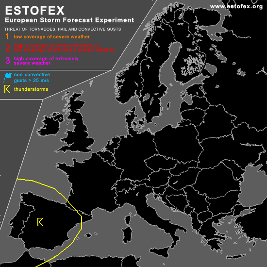

STORM FORECAST
VALID Sun 19 Mar 06:00 - Mon 20 Mar 06:00 2006 (UTC)
ISSUED: 18 Mar 20:25 (UTC)
FORECASTER: DAHL
SYNOPSIS
Though SW European upper cut-off low is expected to undergo some weakening during the period ... associated quasi-stationary SFC low centered just off the Spanish NW coast/SW Biscaya should remain in place with little change in strength. This feature will likely be the primary focus for convective weather this period.
DISCUSSION
...Iberian Peninsula...
Though vort maxima ejecting from the SW European upper low may support sporadic lightning across the S-central Mediterranean sea amidst plume of steep mid-level lapse rates ... bulk of activity should occur over the western Iberian Peninsula in weakly unstable/neutral air mass. LL shear will be rather intense with about 15 m/s 850 hPa flow ... but organized severe threat should be rather low given only marginal deep shear where bulk of activity is expected ... though an isolated severe TSTM event may occur especially towards central Spain where deep shear should be maximized. However ... TSTM coverage may be rather low ... and although kinematic and thermodynamic fields at low levels may favor an isolated ... possibly tornadic ... mesocyclone ... coverage of severe should remain well below level-one thresholds.
#