
STORM FORECAST
VALID Thu 16 Mar 06:00 - Fri 17 Mar 06:00 2006 (UTC)
ISSUED: 15 Mar 20:03 (UTC)
FORECASTER: GATZEN
SYNOPSIS
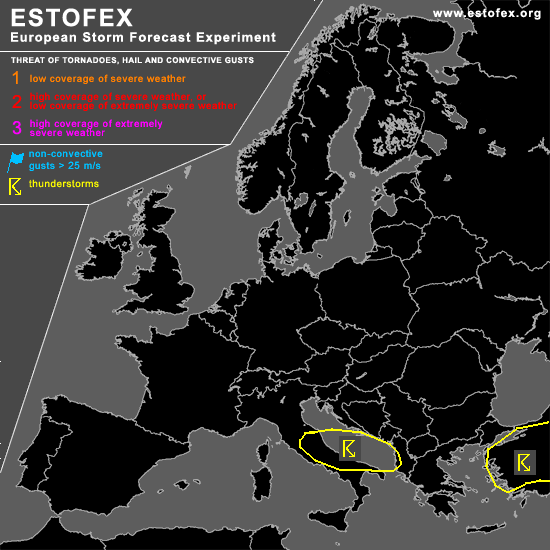
Large high remains from North Sea region to Russia ... while broad area of low geopotential is expected to persist from Black Sea to Alpine region and further to France/Atlantic Ocean W of Iberian Peninsula. Cold and stable airmass will affect most of Europe in the range of the upper high. To the south ... relatively warm airmass has entered Iberian Peninsula east of low geopotential over the Atlantic ... and spreads eastward into western/central Mediterranean. In the range of short-wave troughs propagating eastward ... models suggest that weak instability will form over southern Adriatic Sea ... where WAA and DCVA should lead to QG forcing. Latest ascends do not show significant low-level moisture ... but rather steep low-level lapse rates are present over Adriatic Sea and some instability is not ruled out during the period. Given QG forcing ... showers and thunderstorms are forecast. Strong DLS in the range of the vort-max/associated jet streak may be favorable for a few organized thunderstorms ... and mesocyclones and multicells are not ruled out. Given lack of instability/moisture ... chance for severe convection should be pretty low.
DISCUSSION
#