STORM FORECAST
VALID Mon 13 Mar 06:00 - Tue 14 Mar 06:00 2006 (UTC)
ISSUED: 12 Mar 23:45 (UTC)
FORECASTER: GROENEMEIJER
SYNOPSIS
Monday at 06 UTC... most of Europe will be covered by a cold and dry continental air-mass, swept westward by a strong high pressure system centered over Karelia with a ridge extending towards the Alps. This will inhibit the development of deep, moist convection over much of the continent. In southern Europe a cyclonically-curved jet at mid-levels flanks a low-pressure areato its north, located over the Ionean Sea. The circulation belonging to the associated surface low over Greece, pushes fairly moist air northward across the Aegean Sea and an the eastern Mediterranean.
DISCUSSION
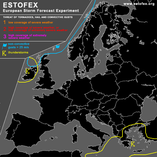
...Turkey, Greece, eastern Mediterranean...
Scattered thunderstorms are forecast across these areas as a result of this moistening in combination with the fairly steep lapse rates that are present in the range of the low-pressure system. A relatively high coverage of storms can be expected where the southerly flow is forced upslope in the coastal areas of Turkey and Greece. In the range of the jet, vorticity maxima may focus upward vertical motion to produce a couple of rather well-organized convective systems. These will however likely not produce much severe weather as low level shear is modest and the amount of instability to be released is low.
...Ireland...
A tongue of warm air on the western flank of the anticyclone covering most of northern Europe is advected northward over the western British Isles. The western part of the warm, moist tongue is basically co-located with a trough and thermal trough at mid-levels: modest amounts of latent instability result and may well give rise to the formation of a few thunderstorms among other moist convection.
#