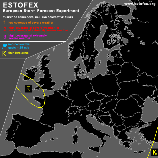

STORM FORECAST
VALID Thu 09 Mar 06:00 - Fri 10 Mar 06:00 2006 (UTC)
ISSUED: 08 Mar 22:33 (UTC)
FORECASTER: GATZEN
SYNOPSIS
European long-wave trough remains ... yielding a northwesterly flow from northeastern Atlantic into Mediterranean. While eastern Mediterranean trough migrates eastward ... another trough enters Europe reaching France during the period. At lower levels ... rather warm maritime airmass has spread into western Mediterranean and western/central Europe. In the range of the following trough ... cold maritime airmass is expected to spread into France. This airmass should be characterized by neutral to slightly unstable lapse rates. Given QG forcing in the range of the vort-max ... showers and thunderstorms should develop. Vertical wind shear should be too weak for a level 1 ... and organized convection seems to be not likely ATTM.
DISCUSSION
#