STORM FORECAST
VALID Tue 07 Mar 06:00 - Wed 08 Mar 06:00 2006 (UTC)
ISSUED: 07 Mar 01:43 (UTC)
FORECASTER: VAN DER VELDE
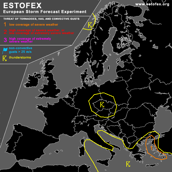
A threat level 1 is forecast across the Aegean Sea and the west coast of Turkey
SYNOPSIS
A longwave upper trough shifts eastwards to about 20 East, with unstable airmass and lift associated with the surface low slightly east of the upper trough, in the Aegean Sea. Warmer airmass will start advecting over western Europe again under the 500 hPa ridge.
DISCUSSION
...Aegean Sea area...
Strong concentrated ascent at the cold front preceded by a plume of high theta-e will release several hundred J/kg CAPE by organised convection. Given the kinematic environment of >30 m/s deep layer shear, a long-lived MCS like that of Albania the day before can be sustained. As NMM and GFS models predict low-level shear and SREH to not coincide with CAPE, risk of supercell storms and bow-echo storms may be somewhat less, nevertheless expect an isolated tornado, large hail or severe gust event to be well possible.
...Mediterranean Sea...
a few waterspouts may occur throughout the thunderstorm area, due to steep lapse rates and low-level instability, though not much of an enhanced chance since winds are not quite calm.
...central Europe...
a weak surface low/through and minor upper trough may still produce some electrified convective activity.
#