STORM FORECAST
VALID Mon 20 Feb 06:00 - Tue 21 Feb 06:00 2006 (UTC)
ISSUED: 19 Feb 20:55 (UTC)
FORECASTER: GROENEMEIJER
SYNOPSIS
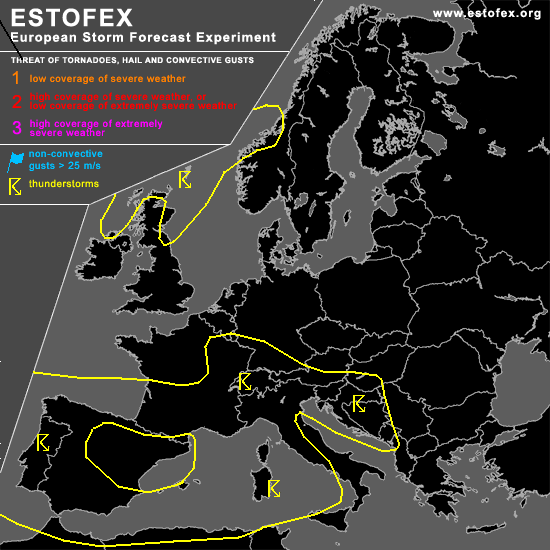
Monday at 06 UTC... a vertically-stacked low pressure area remains located over central France. The stability is low under the aformentioned low pressure area that is filled with cold air at mid-tropospheric levels. Except over northwestern Iberia the moisture content of the lower-tropospheric air is suffient to create some CAPE. As a result, a large area of scattered thunderstorms is forecast. Around the periphery of the low pressure system flows a cylonically-curved jet. Within the flow, two major shortwave troughs are forecast. A shortwave trough initially over northern Italy moves northeastward into Austria, reaching Poland on Tuesday morning. Another shortwave trough northwest of Spain moves southward over the western Iberian Peninsula reaching the western Mediterranean on Tuesday morning. Given that low values of CAPE are expected, severe convective weather is rather unlikely. It is not ruled out however that some strong gusts and small hail will occur under the jet where deep-layer shear is rather strong.... mainly over southwestern Iberia and west-central Italy, and along the Croatian coast.
DISCUSSION
#