
STORM FORECAST
VALID Sat 18 Feb 06:00 - Sun 19 Feb 06:00 2006 (UTC)
ISSUED: 17 Feb 20:28 (UTC)
FORECASTER: DAHL
SYNOPSIS
Allover pattern remains largely unchanged ... with strong zonal upper frontal zone present over S and central Europe ... and several stable perturbations imbedded in it ... and an extensive SFC low-pressure complex ... centered over the N Atlantic ... covering most parts of Europe. Late in the period ... amplifying Atlantic trough and associated strong SFC cyclogenesis with move into the Gulf of Biscay.
DISCUSSION
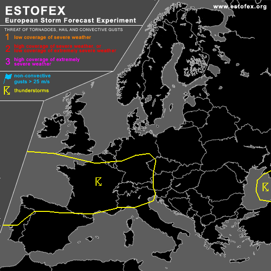
...western and central Europe...
Scattered TSTMS should form again ahead of vort maxima that cross the central portions of Europe during Saturday. Expect gusty outflow winds and possibly some hail with the strongest cells ... but organized severe thret seems to be quite low given weak mesoscale forcing for ascent and weak thermodynamic fields.
In the wake of vigorous DCVA-regime reaching the western Iberian Peninsula and the Gulf of Biscay late Saturday night ... rather deep cellular convection should develop. Organized severe TSTM threat is limited as shear/thermodynamic parameters should be rather weak.
#