
STORM FORECAST
VALID Wed 15 Feb 06:00 - Thu 16 Feb 06:00 2006 (UTC)
ISSUED: 14 Feb 22:51 (UTC)
FORECASTER: GATZEN
SYNOPSIS
Northern Atlantic long-wave trough evades into western Europe ... where stable blocking pattern will remain. At the southern flank of the Atlantic trough strong westerly current with embedded short-wave troughs affects British Isles. Over Mediterranean ... weak long-wave ridge moves eastward. At lower levels ... stable airmass is present over most of Europe and Mediterranean.
DISCUSSION
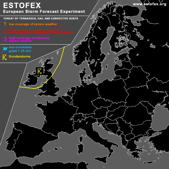
...British Isles...
Interesting situation is forecast over British Isles. Intense long-wave trough will slow down as blocking pattern remains over Europe. Several vort-maxima embedded in the strong westerly flow will rotate around the trough ... leading to strong QG forcing ... and a couple of surface low pressure systems are expected to develop. Affected airmass will me well-mixed ... and CAPE up to several 100 J/kg is forecast by latest GFS model run. This situation seems to be favorable for widespread showers and thunderstorms. Given strong vertical wind shear ... as well as some veering in the lower levels ... thunderstorms may organize into multicells or shallow mesocyclones ... as well as in comma clouds. Severe wind gusts should be the main threat ... but a tornado or hail event is not ruled out. However ... given quite weak instability ... a threat level one seems to be not warrant ATTM. Later observatins have to be awaited for a possible udgrade.
#