STORM FORECAST
VALID Mon 13 Feb 06:00 - Tue 14 Feb 06:00 2006 (UTC)
ISSUED: 12 Feb 15:54 (UTC)
FORECASTER: GROENEMEIJER
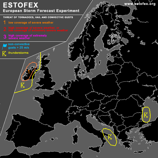
A threat level 1 is forecast across western Ireland
SYNOPSIS
Monday at 06 UTC... a broad and deep longwave trough is expected to stretch from western Russia to the eastern Mediterranean Sea. A ridge extends from western Iberia to the North Sea. Upstream of this ridge, a southwesterly jet approaches the western British Isles.
DISCUSSION
...western Ireland, western Scotland...
Model guidance indicates that a baroclinic wave will develop over the eastern Atlantic and cross western Ireland Monday afternoon. GFS06 develops some instability up to over 5000m ahead of the wave's cold front. There, a 25 m/s low-level jet should bring strong low level shear. This suggests that linear convection which will likely develop on the cold front will have a chance to be accompanied by a few tornadoes as well as strong gusts. Hence, a threat level 1 seems appropriate for this area. Instability in the warm sector of the wave will likely diminish after the passage over Ireland, so that a the threat over Scotland should be lower.
#