
STORM FORECAST
VALID Sun 12 Feb 06:00 - Mon 13 Feb 06:00 2006 (UTC)
ISSUED: 11 Feb 20:03 (UTC)
FORECASTER: DAHL
SYNOPSIS
Rather stationary high-amplitude upper pattern continues ... with large upper low centered over the northern Black Sea region ... extending well into the central and eastern Mediterranean. W European upper ridge will undego some strengthening downstream from vigorous Atlantic upper trough ... which is progged to reach the W British Isles by early Monday morning. Weak vort max currently over NW Spain will cross the Iberian Peninsula on Sunday and move into N Africa in the late evening hours. At the SFC ... high pressure over central Europe will persist ... with polar/arctic air masses across all of Europe except the very SW portions and the British Isles which will be affected by approaching Atlantic System late in the period.
DISCUSSION
...Mediterranean Sea...
The continental polar air which has invaded the Adriatic Sea on Saturday is characterized by very steep lapse rates ... which are nearly dry adiabatic through a layer from the SFC up to 500 hPa. However ... very vow mixing ratios are limiting convective development ATTM. Soundings farther S are somewhat more moist at low levels ... but capped at about 600 to 700 hPa.
Thinking is that shallow convection will persist across much of the southern and eastern portions of the Mediterranean ... with some chances of a few CG's. Allover threat for TSTMS should be rather slim however given low/warm EL heights. Over the Adriatic and the Ionian Sea ... convective development will depend on how quickly LL moisture can be accumulated at low levels. Given lack of any low-level inversion ... weak/no mesoscale LL convergence and rather short fetch ... chances seem to be rather low that widespread TSTMS will form. This is supported by the available models which don't simulate any appreciable CAPE across this region.
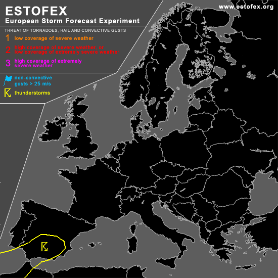
...southern Spain...
Weakly unstable air mass is present across Spain ... given increasing DCVA-related ascent over the western portions of the Iberial Peninsula ... scattered TSTMS should form again in the early afternoon hours. Weak thermodynamic and kinematic fields suggest that severe potential will be quite low with this activity.
#