STORM FORECAST
VALID Fri 10 Feb 06:00 - Sat 11 Feb 06:00 2006 (UTC)
ISSUED: 09 Feb 19:13 (UTC)
FORECASTER: TUSCHY
SYNOPSIS
Well developed upper-level trough / placed over central Europe / will be
nearly stationary during the next 24 hours...Attendant low-level depression
moves slowly towards the SE and is forecast to tranform into an open wave
somewhere east of Austria...Over most parts of Europe, significant TSTM
development is not expected, because of cool and stable
conditions....Although isolated, weakly electrified TSTMS can still develop
under the base of this trough, expect a decrease in all-over activity due to
weakening LL depression.
TSTM threat will be marginal along the extreme SW coast of Portugal, but
slightly cooler mid-level airmass could yield enough instability for a few
isolated TSTMs.
DISCUSSION
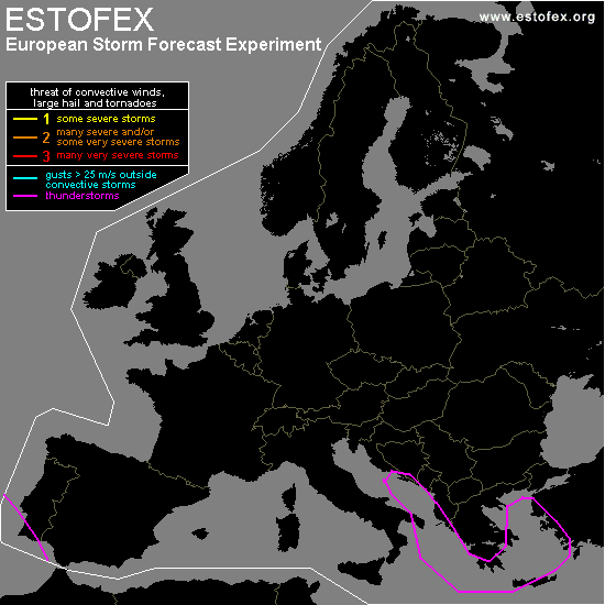
...Eastern Mediterranean...
Broad area of weak pressure falls forecasted over most parts of SE Europe...
Steepening lapse rates due to advection of cold mid-level airmass over the
~12°C Mediterranean should produce at least widespread low-end CAPE
values....Main focus for TSTM development looks like to be a southward
moving cold front ( although slowing down significantly )...There will be an
isolated waterspout/severe wind gust risk mainly along the coastal areas,
where the LL shear is enhanced.
#