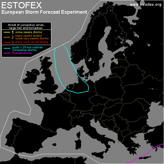

STORM FORECAST
VALID Wed 08 Feb 06:00 - Thu 09 Feb 06:00 2006 (UTC)
ISSUED: 08 Feb 08:45 (UTC)
FORECASTER: GATZEN
SYNOPSIS
East of weak upper ridge extending from Africa southeastwards to Iberian Peninsula ... broad upper trough is present over most of Europe. Over the eastern parts ... this trough is filled with cold polar airmass ... while maritime airmass has spread into western and central Europe. A strong surface low pressure system moves eastward over southern Scandinavia/northern Germany during the period ... associated with rather intense upper short-wave trough. Over Mediterranean ... upper long-wave trough will migrate eastward at the southern flank of European long-wave trough ... while lee cyclogenesis is expected underneath the strong northwesterly jet south of western Alps.
DISCUSSION
...Germany, southern Denmark...
In the range of intense surface low pressure system ... strong upper short-wave trough will migrate eastward over Germany/Denmark ... providing quite strong QG forcing. At lower levels ... a cold front occlusion will travel eastward over Germany. Affected airmass is characterized by quite rich low-level moisture and neutral lapse rates in the lower levels. Expect that maritime airmass will deepen in the range of the trough axis ... negative LIs may be possible ... and showers may be thundery over parts of Germany ... and given rather strong vertical wind shear ... severe thunderstorms capable of producing soft hail and severe wind gusts are not ruled out over all of Germany. However ... given weak instabilty ... and the fact that most wind gusts will be related to synoptic pressure gradient ... a level one will be not issued.
#