STORM FORECAST
VALID Tue 07 Feb 06:00 - Wed 08 Feb 06:00 2006 (UTC)
ISSUED: 07 Feb 01:42 (UTC)
FORECASTER: VAN DER VELDE
SYNOPSIS
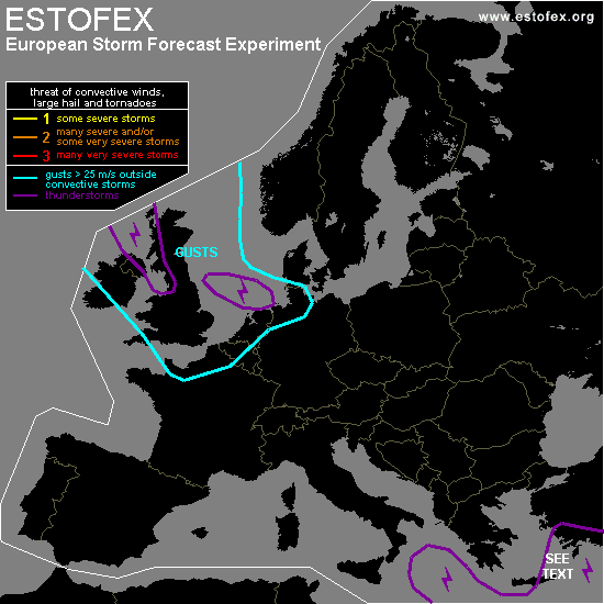
A developing low will swing into the North Sea area from the northwest, affecting the British Isles, the Benelux, northwestern France, northwestern Germany and Denmark. Widespread severe gusts are anticipated, but convection is likely to play only a small role. GFS 18Z indicates no CAPE on the cold front (18Z coming out of Scotland, Wed 06Z over The Netherlands), so the strong SREH is not likely to be ingested in any convection. The energy from the postfrontal convection seems to originate in the warmer ocean surface layer, so that any storms will weaken inland. An isolated tornado cannot be ruled out if a storm manages to tilt the strong low-level shear caused by friction over land.
Second area of interest is the upper low near Greece and Turkey, causing abundant convection. A waving cold front is lingering near Crete and southwestern Turkey. At its east side most CAPE is available (several hundred J/kg) but it is not likely to be combined with favourable shear conditions to form rotating updrafts or a long-lived MCS, unless at the front itself - an isolated tornado or large hail event may not be ruled out. Expect coverage to be adequate for '0' threat level. Weak storms may rather cause relatively rainy conditions by clustering at the front.
DISCUSSION
#