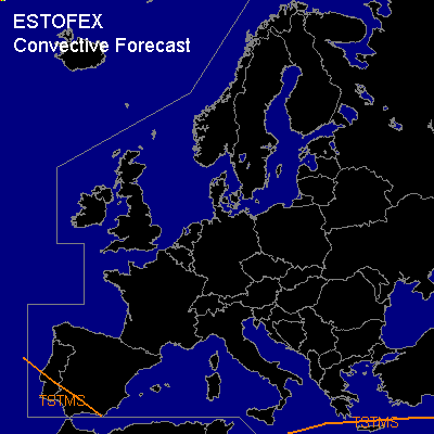

CONVECTIVE FORECAST
VALID Wed 25 Jan 06:00 - Thu 26 Jan 06:00 2006 (UTC)
ISSUED: 24 Jan 19:57 (UTC)
FORECASTER: GATZEN
Thunderstorms are forecast across
SYNOPSIS
Well-developed and amplified upper long-wave trough ... filled with arctic/polar airmass has reached eastern Mediterranean ... where unusually cold situation is expected. To the west ... southern branch of the polar jet is directed towards Iberian Peninsula. An embedded short-wave trough should reach the western parts during the period. To the north ... blocking situation over most of Europe remains ... while upper trough cuts off over central Europe during the day. At lower levels ... cold or very cold and stable airmass covers most of Europe. Over Iberian Peninsula ... maritime airmass is expected to spread into the extreme southwestern parts. This airmass should be characterized by neutral lapse rates and quite rich low-level moisture. Given rather strong QG forcing at the leading edge of propagating short-wave trough ... as well as low-level forcing that should be likely along a cold front entering the southwestern parts during the night hours ... scattered showers and thunderstorms are expected. However ... vertical wind shear should be quite weak ... as upper jet streak will be far southward ... and severe thunderstorms are not forecast.
DISCUSSION
...Eastern Mediterranean...
Over eastern Mediterranean ... rather warm water temperature will create steep low-level lapse rates ... and showers are expected to form, some of them may be accompanied by thunder. However ... given weak CAPE and decreasing QG forcing at the western flank of weakening long-wave trough ... as well as quite shallow cold airmass ... low EL heights ... and unfavorable vertical wind shear over most of the region ... chance for strong thunderstorms should be low.
...Iberian Peninsula...
Over Iberian Peninsula ... maritime airmass is expected to spread into the extreme southwestern parts. This airmass should be characterized by neutral lapse rates and quite rich low-level moisture. Given rather strong QG forcing at the leading edge of propagating short-wave trough ... as well as low-level forcing that should be likely along a cold front entering the southwestern parts during the night hours ... scattered showers and thunderstorms are expected. However ... vertical wind shear should be quite weak ... as upper jet streak will be far southward ... and severe thunderstorms are not forecast.
#