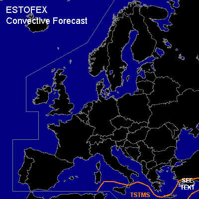

CONVECTIVE FORECAST
VALID Tue 24 Jan 06:00 - Wed 25 Jan 06:00 2006 (UTC)
ISSUED: 24 Jan 09:42 (UTC)
FORECASTER: VAN DER VELDE
Thunderstorms are forecast across southern Mediterranean to southern Turkey
SYNOPSIS
A very cold and stable airmass is present over the Balkan, central and eastern Europe, under a strong high pressure area. Deep convection can only form south of this airmass that is advected into the Mediterranean. Due to strong low-level lapse rates and buoyancy, waterspouts may occur.
DISCUSSION
...southern Turkey...
A depression moves slowly eastward, advecting warm unstable air towards the south coast of Turkey, and deep convection may develop, helped by lift at the cold front. Several tens of millimeters of precipitation may fall and cause local flash flooding. Deep layer shear is enhanced to over 20 m/s in this region, and may support long-lived convective systems, however the storm rotation potential is rather low due to meager low-level shear and s-r helicity in areas of instability and trigger. Still, an isolated tornadic/waterspout event may occur.
#