CONVECTIVE FORECAST
VALID Mon 23 Jan 12:00 - Tue 24 Jan 06:00 2006 (UTC)
ISSUED: 23 Jan 13:04 (UTC)
FORECASTER: GROENEMEIJER
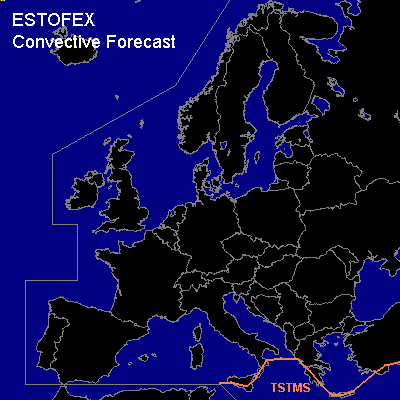
Thunderstorms are forecast across perts of the south-central and eastern Mediterranean Sea and some adjacent coastal areas.
SYNOPSIS
Monday at 12 UTC... a complex mid-tropospheric flow pattern was present over Europe, with a large-amplitude NE-SW'ly oriented trough extending from a low pressure centre over the northern Ukraine to central Italy. A very cold and stable continental air-mass is present northwest of a cold front across southern Turkey, the Aegean Sea, southern Greece westward to Sardinia. Over the southern Aegean and parts of the central Mediterranean south of the front, up to a few 100s J/kg of CAPE are available for deep convection. A couple of thunderstorms are indeed expected to persist or form int he indicated areas. Given the low degree of instability, the storms will likely not be severe.
DISCUSSION
#