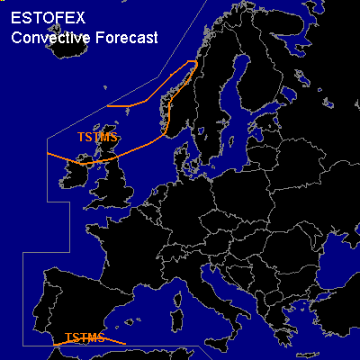

CONVECTIVE FORECAST
VALID Wed 11 Jan 06:00 - Thu 12 Jan 06:00 2006 (UTC)
ISSUED: 10 Jan 21:13 (UTC)
FORECASTER: GATZEN
Thunderstorms are forecast across northern North Sea
Thunderstorms are forecast across south-western Mediterranean
SYNOPSIS
Main zonal flow has a northerly position ... and strong westerly jet stretches from northern British Isles to Scandinavia and further to western Russia. Intense cyclogenesis takes place over northern British Isles and should affect central Scandinavia on Wednesday. Behind the cold front ... showers should form in the range of a vort-max. A few thunderstorms are not ruled out. Given weak instability and weak forcing ... chance for organized convection should be low ... and organized thunderstorms are not expected. To the south ... Atlantic high ridges into Iberian Peninsula, Bay of Biscay, Germany, Belarus, and western Russia ... yielding a northerly flow over Mediterranean. Stable airmass characterized by poor low-level moisture is present over most of Mediterranean and should spread into southern and southwestern Mediterranean, where moist airmass is present ATTM. A few thunderstorms may form initially, though.
DISCUSSION
#