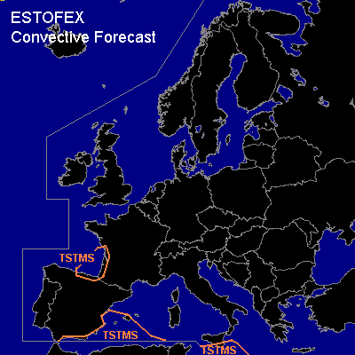

CONVECTIVE FORECAST
VALID Mon 09 Jan 06:00 - Tue 10 Jan 06:00 2006 (UTC)
ISSUED: 08 Jan 22:32 (UTC)
FORECASTER: GROENEMEIJER
Thunderstorms are forecast across the eastern Bay of Biscay, southwestern France and southern parts of the western an central Mediterranean Sea.
SYNOPSIS
Monday at 06 UTC... the strong polar jet stream is located far north and an intense trough near Iceland is expected to cause unsettled weather over northern Europe later this week. It will likely not be associated with much deep convective activity on Monday.
To the south... a low pressure centre over the Bay of Biscay may create enough deep instability to allow for a couple of thunderstorms to form along the French coast as it moves southward.
During the forecast period, convective storms are most likely over the southern Meditarrenean. Rising motions ahead of a slowly eastward moving mid/upper low over Tunisia are expected to destabilize the air-mass to the south and southeast of Sicily, which will likely result in a couple of thunderstorms. To the west, isolated convective storms are possible south and southeast of Spain, especially when the aformentioned Biscay low causes quasigeostrophic forcing for upward motion across the area in the last 6 to 12 hours of the forecast period.
DISCUSSION
#