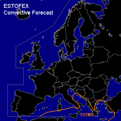

CONVECTIVE FORECAST
VALID Wed 28 Dec 06:00 - Thu 29 Dec 06:00 2005 (UTC)
ISSUED: 27 Dec 20:38 (UTC)
FORECASTER: GATZEN
Thunderstorms are forecast across Adriatic and Aegean Sea
SYNOPSIS
Dominating feature over Europe is high over low blocking pattern present over Central Europe. Most of the European continent is flooded by cold airmass, and CAPE is unlikely over land. Over Baltic and North Sea ... quite steep lapse rates are present ... and showers and isolated thunderstorms have formed on Tuesday and won't be ruled out during the period. However ... given that only a few tstms are expected ... extra tstms region is not shown in the graphic. To the south ... base of European trough affects central Mediterranean. On Wednesday ... strong jet streak propagates eastward over northern Mediterranean ... and stabilization due to CAA and DAVA is indicated by latest model output. To the east ... a short-wave trough propagates eastward over Adriatic and Aegean Sea. Affected airmass is characterized by steep low level lapse rates and neutral to slightly unstable airmass aloft as indicated by latest ascends ... and CAPE uo to 100 J/kg should be possible. As caping inversion is weak ... showers and thunderstorms should form underneath the trough axis. Weak vertical wind shear does not increase likelyhood of organized convection. Chance for a few waterspouts may be enhanced due to low LCL heights/steep low-level lapse rates. Threat should be low.
DISCUSSION
#