CONVECTIVE FORECAST
VALID Mon 26 Dec 06:00 - Tue 27 Dec 06:00 2005 (UTC)
ISSUED: 25 Dec 23:59 (UTC)
FORECASTER: GROENEMEIJER
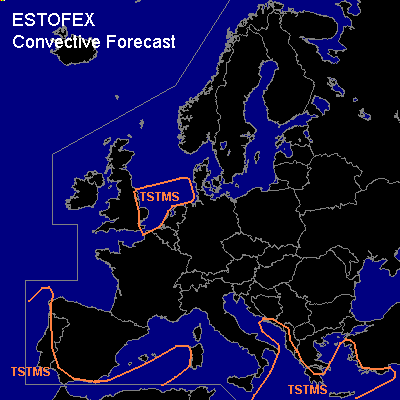
Thunderstorms are forecast across western Iberia and parts of the western Mediterranean Sea, the Ionean Sea, Greece, the Aegean Sea and parts of of western and southwestern Turkey and ajacent waters... and across the southern North Sea and the eastern UK.
SYNOPSIS
Monday at 06 UTC ... a strong anticyclone is expected north of Scotland. A low-pressure centre -initially over the western Baltic Sea- is expected to have moved to western Germany/Belgium by Tuesday morning. A moderate westerly flow is expected to persist over the Mediterranean Region. Unstable air is present west and southwest of Iberia. Lifting ahead of a shortwave trough from the Atlantic Ocean is expected to induce instability south of Iberia around 18Z and later further east as well. Warm air advection in the lower troposphere is expected to aid destabilisation over the Ionean and Aegean Seas.
DISCUSSION
#