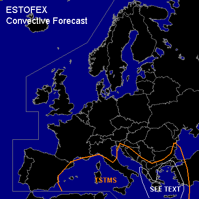

CONVECTIVE FORECAST
VALID Thu 08 Dec 06:00 - Fri 09 Dec 06:00 2005 (UTC)
ISSUED: 08 Dec 00:07 (UTC)
FORECASTER: GATZEN
SYNOPSIS
European trough remains, as another short-wave trough ejects into western Europe during the period. Downstream ... upper ridge amplifies into Scandinavia/British Isles. Cold airmass dominates the forecast region.
DISCUSSION
...Mediterranean...
A short-wave trough present over Italy travels eastward crossing southern Balkans/Aegean Sea during the period ... leading to QG forcing. Affected cold airmass is characterized by steep low-level lapse rates over the warm sea surface. Some showers and thunderstorms are expected to form. Due to enhanced vertical wind shear ... isolated severe events ... with severe wind gusts the most significant threat ... are not ruled out. However ... weak forcing ... and poor boundary layer moisture seem to inhibit strong convection. Over western Mediterranean ... approaching trough may lead to additional thunderstorms. Weak thermodynamic profiles and rather weak vertical wind shear should be present ... and severe thunderstorms are not expected ATTM.
#