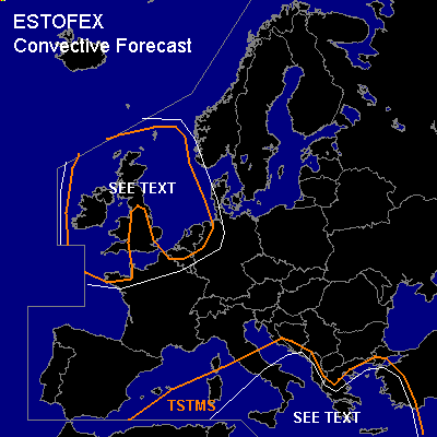

CONVECTIVE FORECAST
VALID Thu 24 Nov 09:00 - Fri 25 Nov 06:00 2005 (UTC)
ISSUED: 24 Nov 08:42 (UTC)
FORECASTER: GATZEN
SYNOPSIS
Intense outbreak of arctic airmass will take place over North Sea region ... supporting an amplified long-wave trough over Europe. To the south ... cut-off low over Mediterranean merges to this long-wave trough and propagates NEward. At lower levels ... polar airmass is present over most of the Mediterranean ... characterized by steep low-level lapse rates and poor boundary-layer moisture. Decreasing QG forcing and stabilization is forecast ... and chance for thunderstorms is limited. Although strong vertical wind shear will remain at the SErn flank of the upper low ... organized storms are not expected to form due to poor thermodynamic profiles indicated by latest ascends. Over North Sea region/British Isles ... arctic airmass is forecast to destabilize due to warm sea surface in the range of the upper trough. Showers and thunderstorms will likely form ... accompanied by soft hail and snow. As vertical wind shear will be strong ... a few bowing segments ... capable of producing severe wind gusts ... are not ruled out. Over land ... strong LLS is forecast ... enhancing the chance for tornadoes, but overall threat seems to be relatively low.
DISCUSSION
#