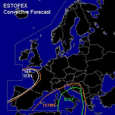

CONVECTIVE FORECAST - UPDATE
VALID Fri 21 Oct 13:00 - Sat 22 Oct 06:00 2005 (UTC)
ISSUED: 21 Oct 13:28 (UTC)
FORECASTER: DAHL
There is a slight risk of severe thunderstorms forecast across the central Mediterranean.
SYNOPSIS
Refer to convective forecast from 20 Oct 2005.
DISCUSSION
...central Mediterranean...
CAPE over the central Mediterranean turns out to be quite substanial ... LIEE 00Z featured MLCAPE of about 2500 J/kg with a nearly saturated BL and no CINH. LIEE 06Z launch has somewhat weaker CAPE but thermodynamic fields at low levels are still favorable for tornadoes. MM5 advertises increasing 850 hPa flow during the rest of the period ... which will additionally enhance the tornado threat. Expect one or more MCSs to continue through the period ... with embedded tornadic mesocyclones. Also ... isolated large hail and damaging straight-line winds may occur. Deep-layer shear appears to remain fairly weak ... will thus not introduce a MDT.
Activity over central portions of Europe and central France should remain too isolated for a TSTM outlook.
#