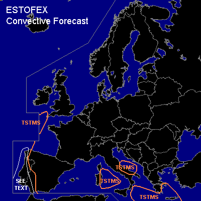

CONVECTIVE FORECAST
VALID Mon 10 Oct 12:00 - Tue 11 Oct 06:00 2005 (UTC)
ISSUED: 10 Oct 09:51 (UTC)
FORECASTER: GROENEMEIJER
SYNOPSIS
Monday at 9 UTC... in the mid-troposphere a broad trough stretches from near Iceland to the Canary Islands upstream of a blocked flow pattern formed by high pressure over western Russia and the Baltic States and a low over the southern Balkans. Patches of low latent instability linger over the central Mediterranean.
DISCUSSION
...Portugal, western Spain...
Rather warm and moist air is advected northward in the area between Madeira and the Iberian peninsula. Convection is occurring across an area west of Lisbon and further south in association with tropical storm Vince as well as across southern parts of the peninsula. In response to the diurnal cycle, convection should become more widespread over land this afternoon while advection of storms off the sea will become more important as well.
With low-level shear increasing to over 10 m/s near Spain, some storms may develop rotating updrafts resulting a small threat of hail, strong winds and perhaps a tornado or two. The strongest storms are expected across the Portugese and Spanish south coasts, where deep-layer shear will be strongest.
#