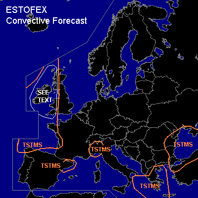

CONVECTIVE FORECAST
VALID Sat 24 Sep 12:00 - Sun 25 Sep 06:00 2005 (UTC)
ISSUED: 24 Sep 12:43 (UTC)
FORECASTER: GROENEMEIJER
SYNOPSIS
Saturday at 12 UTC... the flow over most of central and southern Europe was weak, while a southwesterly flow was present ahead of a trough over the Atlantic Ocean. The trough is expected to reach Ireland on Sunday morning.
DISCUSSION
...Ireland, UK...
A weak cold front is expected to reach western Ireland during the late afternoon and move eastward during the evening and night. Some instability is expected in the air-mass behind the front and scattered convective storms are forecast. It is possible that some instability forms ahead of the cold front and that one or more lines of convection form nearby the front. A weak tornado or two may then be able to form as the flow ahead of the front is rather helical. Because of the questions concerning the availability of instability, this threat can be considered small.
#