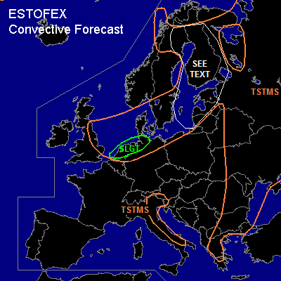

CONVECTIVE FORECAST
VALID Wed 20 Jul 09:00 - Thu 21 Jul 06:00 2005 (UTC)
ISSUED: 20 Jul 08:24 (UTC)
FORECASTER: GROENEMEIJER
There is a slight risk of severe thunderstorms forecast across the Netherlands and northwestern Germany
SYNOPSIS
Wednesday at 06Z a low pressure area at mid-levels was centered over the North Sea. An intense shortwave trough extending from its centre to the central British Isles is expected to swing over the Low countries into Germany during the forecast period.
DISCUSSION
...The Netherlands, northwestern Germany
...
Strong wind shear is observed and forecast to persist over the Netherlands and northern Germany until passage of the mid/upper trough. DCVA-related ascent and strong warm air advection ahead of the trough is expected to lead to upward vertical motion that increases the depth of the convective layer. As rather strong low level shear in the 10-15 m/s range and more than 100 m2/s2 of 0-1 km SREH are expected in combination with high CAPE values below 3 km AGL, there seems to be the potential of small rotating updrafts/supercells capable of producing tornadoes. Any rotating updrafts maty well be embedded in convective lines, that are expected to become the main covnective mode as a surface cold front sweeps through the Netherlands and northern Germany this afternoon and evening. Additionally some locally strong straight-line winds are possible.
...Baltic Sea, Baltic States, northern Sweden, Finland...
Moist soundings showing high values of low-level CAPE suggest a continued potential for waterspouts.
#