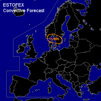

CONVECTIVE FORECAST
VALID 06Z THU 17/03 - 06Z FRI 18/03 2005
ISSUED: 16/03 19:07Z
FORECASTER: GATZEN
General thunderstorms are forecast across southern Scandinavia
SYNOPSIS
Upper ridge present over western Mediterranean. To the north ... a strong upper jet is present over southern Scandinavia. A strong vort-max is expected to travel eastwards over southern Scandinavia during the period.
DISCUSSION
...Southern Scandinavia...
Well developed frontal boundary is present over southern Scandinavia ... with rather dry, warm airmass to the south. On Thursday ... frontal wave is expected to travel eastwards along this boundary ... and rather moist maritime airmass should spread into North Sea region/southern Scandinavia west of a occlusion. This airmass should be characterized by neutral lapse rates and rather rich low-level moisture as indicated by latest ascends over western Europe. In the range of the upper trough ... rather strong DCVA will be likely ... as well as some WAA ... that should lead to some instability. Current thinking is that showers and thunderstorms will form in the range of the maritime airmass. Vertical wind shear will be weak in the range of the upper trough, and severe thunderstorms are not expected.
#