CONVECTIVE FORECAST
VALID 06Z WED 09/03 - 06Z THU 10/03 2005
ISSUED: 08/03 21:21Z
FORECASTER: GROENEMEIJER
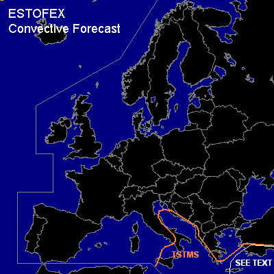
General thunderstorms are forecast across parts of the south-central and eastern Mediterranean Regions
SYNOPSIS
Wednesday at 06Z... a WSW flow is present ahead of a trough initially along a line from the Crimean peninsula to southern Tunisia. Behind the trough, cold and ustable air flows southeastward.
DISCUSSION
...southern Aegean Sea, southern Turkey...
A few storms are expected over the area nearby the axis of the WSW-ly 500 hPa jet. Hence, the presence of ample shear suggests there is a limited risk of isolated severe weather despite CAPE being low and large-scale forcing for upward vertical motion being weak. Some marginally large hail and strong gusts may occur.
#