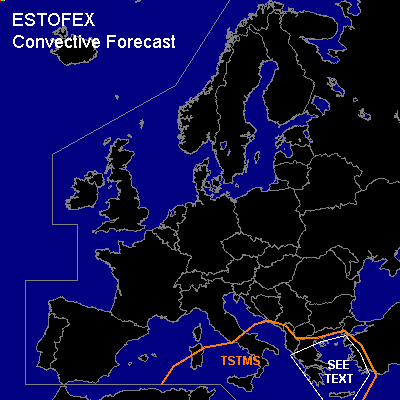
CONVECTIVE FORECAST
VALID 06Z TUE 08/03 - 06Z WED 09/03 2005
ISSUED: 08/03 01:11Z
FORECASTER: VAN DER VELDE
General thunderstorms are forecast across part of the Mediterranean Sea, including coastal areas of Italy, Greece and Turkey
SYNOPSIS
Blocking high pressure remains over the northern Atlantic Ocean, with lows over Russia and near Greece. A cold flow from the north affects most of Europe. A frontal zone with waves lingers around Greece and Turkey.
DISCUSSION
...Greece and Turkey...
Slightly unstable profiles and strong lift are expected for that area (GFS, NMM), leading to some deep convection, but SREH and low-level shear should remain fairly marginal according to GFS 18Z, limiting the probability of organised severe weather to rather isolated severe gusts.
However... Brindisi 00Z sounding does show favorable lapse rates for convection and strong veering and increase of the wind with height with 40 kts at 850 hPa, which seems to be much stronger in speed and SREH than either NMM or GFS. A SLGT risk may be required if organised convection does manage to develop under these kinematic conditions.
#