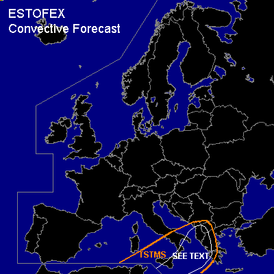

CONVECTIVE FORECAST
VALID 06Z FRI 04/03 - 06Z SAT 05/03 2005
ISSUED: 03/03 15:41Z
FORECASTER: GATZEN
General thunderstorms are forecast across southern Mediterranean, southern Italy, southern Aegean, southern Balkans, western Greece
SYNOPSIS
Blocking upper high remains over northern Atlantic and ridges into Iceland. At its eastern flank, upper troughs move southward into western and southwestern Europe, where low geopotential will remain on Thursday. To the east of this upper long-wave trough ... a very strong upper jet is present over Mediterranean ... yielding to very strong deep layer wind shear. At lower levels ... east of complex surface low pressure systems moving northeastward over western and northern Mediterranean ... strong WAA is expected from southern to northeastern Mediterranean on Thursday.
DISCUSSION
...Aegean, southern Italy, southern Balkans, western Greece...
On Thursday ... a very strong WSWerly upper jet is located over the Mediterranean. Several vort-maxima embedded in the mean flow will travel ENE-ward. At lower levels ... a rather complex low is expected to move eastward over northern Mediterranean. To the west ... cold and dry airmass is expected to spread into western Mediterranean. East of the propagating cold front ... latest model output shows increasing WAA from southern Mediterranean into southern Aegean Sea, southern Italy, and southern Balkans. Warm airmass over northern Africa is stable as indicated by latest ascends, and a strong capping inversion is expected to form in the warm sector of mentioned surface low. Over the Mediterranean ... models suggest significant moisture increase underneath the inversion ... and dewpoints are forecast in the lower 10s °C on late Thursday/early Friday over southern Aegean Sea. Rather strong QG forcing may lead to mid troposphere cooling as indicated by GFS model output ... showing negative LIs and CAPE of some 100 J/kg. It is still questionable that this amount of instability will be realized on early Friday. However ... rather strong forcing is expected along the cold front ... where low-level WAA should be strongest ... and showers and thunderstorms are forecast to form. Very strong deep layer wind shear as well as favorable low level veering as indicated by numerical models should be more than adequate for mesocyclones. Very strong low-level wind shear as well as rather low LCL heights are expected, and chance for tornadoes should be enhanced. Even a strong tornado is not ruled out due to strong low-level wind shear. Isolated large hail and severe wind gusts are also possible with any supercell that forms. The uncertainty of forecast instability prevents from a SLGT ATTM ... later observations have to be awaited to discuss the evolution of low-level moisture and instability on Thursday.
#