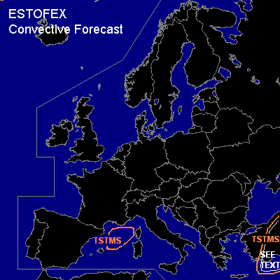

CONVECTIVE FORECAST
VALID 06Z WED 02/03 - THU 03/03 2005
ISSUED: 01/03 23:44Z
FORECASTER: GROENEMEIJER
General thunderstorms are forecast across
SYNOPSIS
Wednesday at 06 UTC... a strong westerly flow is located over the Mediterranean Sea. At the surface a frontal zone stretches from northern Turkey to central Tunisia. A stable frontal wave is initially located over the Ionean Sea and moves rapidly eastward.
DISCUSSION
...Turkey...
Weak synoptic-scale upward motions are expected over western Turkey in conjunction with the aforementioned baroclinic wave. As the air-mass over western and southern Turkey is expected to become slightly unstable (a few 100's of J/kf SBCAPE may form), a few thunderstorms may result. As both deep-layer and low-level shear are large, it is possible that some storms develop mesocyclones. A marginal risk of severe winds, large hail, and possible even a tornado result. The low amounts of forcing for upward vertical motion and CAPE suggest the entire event will be marginal and a slight risk is not issued.
#