CONVECTIVE FORECAST
VALID 06Z MON 28/02 - 06Z TUE 01/03 2005
ISSUED: 27/02 23:53Z
FORECASTER: GROENEMEIJER
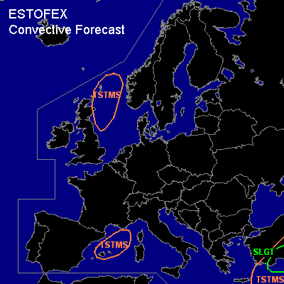
General thunderstorms are forecast across parts of the western Mediterranean Sea, southwestern Turkey and parts of the eastern Mediterranean Sea, and across the northwestern North Sea.
SYNOPSIS
Monday at 06 UTC... a frontal zone is west-east oriented over the Mediterranean Sea. A westerly 40 m/s jet at mid and upper-levels is associated with the front.
DISCUSSION
...southwestern Turkey and parts of the eastern Mediterranean...
A weak vort max is moving eastward over the Mediterranean and expected to induce rising motions to overspread the Turkish south coast during Monday. A few 100's of J/kg of MLCAPE should form per GFS_12Z and orographically induced rising motions should suffice to initate storms. Considering that 25-30 m/s 0-6 km and in excess of 10 m/s 0-1 km bulk shear are forecast, there is some potential for a couple of supercells/ bows to form despite the weak CAPE. There is a threat of large hail, strong to severe winds and perhaps a tornado as well.
...Western Mediterranean...
Over the western mediterranean, the front is moving southward. Rising motions leading to destabilsation may lead to the formation of some latent instability around and northeast of the Balearic Isles and a few thunderstorms may result.
#