CONVECTIVE FORECAST
VALID 06Z WED 23/02 - 06Z THU 24/02 2005
ISSUED: 23/02 00:17Z
FORECASTER: GROENEMEIJER
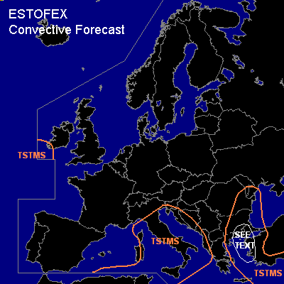
General thunderstorms are forecast across the entire central Mediterranean region, eastern Greece, the Aegean Sea, western Turkey the extreme eastern Balkans and across extreme southwestern Ireland.
SYNOPSIS
Wednesday at 06 UTC... a mid/upper low pressure area is located over the Alps. A westerly midtropospheric flow is present over the Mediterreanean. Under influence of the left exit region of a jet streak located over the northern Thyrrenean Sea a suirface cyclone is expected to deepen. It is expected to be over Slovakia on Thursday morning. Severe convection seems not very likely with this system given weak thermodynamic support.
DISCUSSION
...northeastern Greece, western Turkey and the Aegean Sea...
A cold front is expected to be over the western Aegean Sea. MUCAPE around 500 J/kg is expected ahead of the front an thunderstorms will likely occurring along or nearby the frontal zone. Moderate 15-20 m/s (0-6 km) deep-layer shear may allow for several more-or-less organised clusters to form that create a low probability of a few marinally severe hail or wind events. A risk category seems not to be needed.
#