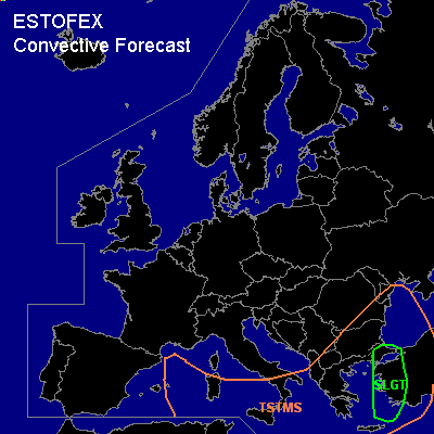

CONVECTIVE FORECAST
VALID 06Z WED 16/02 - 06Z THU 17/02 2005
ISSUED: 15/02 23:20Z
FORECASTER: GROENEMEIJER
There is a slight risk of severe thunderstorms forecast across western Turkey
General thunderstorms are forecast across parts of the western Mediterranean, southern Italy, the southern and eastern Balkans, parts of Greece, western Turkey.
SYNOPSIS
Wednesday at 06 UTC... a large low pressure area is forecast to be located over central Italy. A frontal zone is stationary over western Turkey and the west coast of the Black Sea. A cyclonically curved jet is forecast from the Bay of Biscay, Spain, Algeria, Libia to western Turkey.
DISCUSSION
...Western Turkey...
To the east of the frontal zone, warm, unstable air is advected northward (MUCAPEs may rise to 600-800 J/kg). UVM will likely lead to the formation of storms along the Turkish southwestern and western coasts. As GFS/NMM forecast between 200 and 300 m2/s2 0-3 km SRH, supercells will probably form. These may be accompanied by severe gusts, large hail and possible even one or two tornadoes.
#