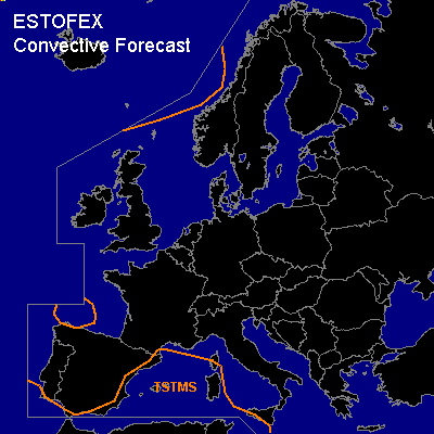

CONVECTIVE FORECAST
VALID 06Z TUE 08/02 - 06Z WED 09/02 2005
ISSUED: 07/02 23:21Z
FORECASTER: VAN DER VELDE
General thunderstorms are forecast across the western Mediterranean Sea
General thunderstorms are forecast across the ocean north of Scotland and west of Norway
SYNOPSIS
A cut-off low pressure system migrates from near the Iberian Peninsula to northern Africa. A ridge of high pressure expands westwards from the blocking Eastern Europe anticyclone. Unstable air follows behind an occlusion associated with the depression heading for Norway.
DISCUSSION
...western Mediterranean Sea...
Negative LIs and convergent low level flow indicate continuation of thundery weather over much of the area. Incidentally, a few waterspouts are well possible, if the good GFS-indicated low level buoyancies and benign shear are going to be realised. This seems feasible, given the upstream Mon 12Z Cagliari sounding.
#