CONVECTIVE FORECAST
VALID 09Z MON 07/02 - 06Z TUE 08/02 2005
ISSUED: 07/02 09:16Z
FORECASTER: GROENEMEIJER
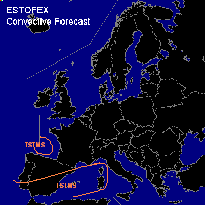
General thunderstorms are forecast across the southern, eastern and central Iberian peninsula, the western Mediterranean Sea and across the Bay of Biscay.
SYNOPSIS
Monday at 06 UTC... the flow over Europe is blocked, with a weak mid/upper level low-pressure area was located over Portugal and a weak ridge over Poland.
DISCUSSION
...Western Mediterranean, Iberia...
Over the western Meditarranean and the southeastern half of Iberia, a wide area of weak ascent is analyzed and forecast to persist consistent with the analyzed weak warm air advection. This is expected to lead to gradual destabilization of the air-mass, which will likely allow thunderstorm activity to increase over the area. Weak vertical wind shear will probably not allow for much severe weather to occur with these storms. A few waterspouts over the western Mediterranean will however be possible.
#