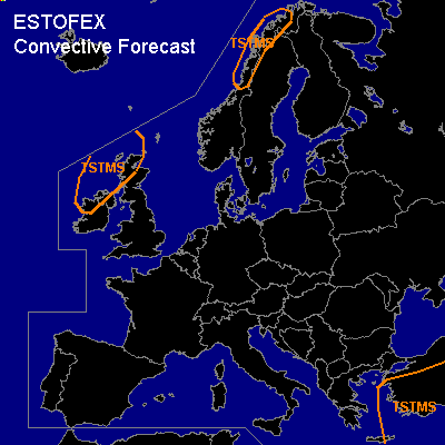

CONVECTIVE FORECAST
VALID 06Z FRI 04/02 - 06Z SAT 05/02 2005
ISSUED: 03/02 17:17Z
FORECASTER: GATZEN
General thunderstorms are forecast across southeastern Europe
General thunderstorms are forecast across northwestern Europe and northwestern Scandinavia
SYNOPSIS
Blocking high present over northwestern Russia. To the south ... long-wave trough placed over eastern Mediterranean, where cold airmass has spread over the forecast region. Shallow thunderstorms should be possible over the Aegean Sea and Turkey, where little CAPE should be possible in the range of the trough axis. However ... rather low vertical wind shear should limit severe potential. Over northwestern Europe ... another long-wave trough will split into two parts. The northern parts should cross Scandinavia during the day, and showers are expected as low-level airmass should be quite moist with neutral lapse rates. Along the Scandinavian coast ... thunderstorms may form due to orographic lift. Severe storms are not completely ruled out near the coast, where low-level 0-1km vertical wind shear may reach more than 10 m/s. The southern part of mentioned long wave trough is expected to amplify over western Europe. Showers and isolated thunderstorms may form in the range of the trough axis, where weak vertical wind shear should limit severe potential.
DISCUSSION
#