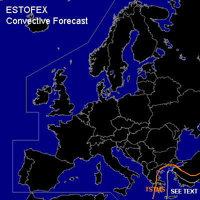

CONVECTIVE FORECAST
VALID 06Z THU 03/02 - 06Z FRI 04/02 2005
ISSUED: 02/02 13:49Z
FORECASTER: GATZEN
General thunderstorms are forecast across Greece, Aegean Sea, western and southern Turkey
SYNOPSIS
Relatively strong westerly flow present over the northern Atlantic and northwestern Europe between upper ridge over Great Britain and upper trough north of Iceland. Over southern Scandinavia ... delta of Atlantic westerly jet is present west of blocking high over Russia ... and southern branch of the jet spreads over central Europe into Mediterranean, where it forms intense long-wave trough over eastern Mediterranean.
DISCUSSION
...Eastern Mediterranean
...
In the range of the upper long-wave trough over eastern Mediterranean, cyclogenesis is expected over Aegean Sea during the forecast period. To the east ... WAA is forecast over Turkey east of propagating surface cold front. Warm airmass is characterized by rather steep low-level lapse rates as indicated by latest 16754 Heraklion sounding ... and CAPE in the order of 200 J/kg is expected due to increasing low-level moisture. On Thursday ... a slightly positively tilted short-wave trough is expected to spread northeastward over the warm sector of deepening low pressure system centering over the Aegean Sea ... and intense QG UVM is expected. Weak CIN and strong forcing should be sufficient for initiation ... and thunderstorms are forecast in the warm sector and along the cold front. Vertical wind shear is forecast to be rather poor in the range of the upper trough as indicated by GFS model run. However ... current thinking is that at least 10 m/s low level wind shear should be possible near the Turkish coast ... and thunderstorms may organize into bow echoes or mesocyclones. A few severe events are not ruled out over eastern Aegean Sea and along the Turkish coast. There is also slightly enhanced threat for tornadoes, as low LCL heights are forecast over the Aegean Sea. We do not decide to issue a slight risk as models do not show strong vertical wind shear at this time. West of the cold front ... strong CAA should lead to subsidence ... and only isolated thunderstorms are expected. Strong surface pressure gradient should lead to strong wind gusts.
#